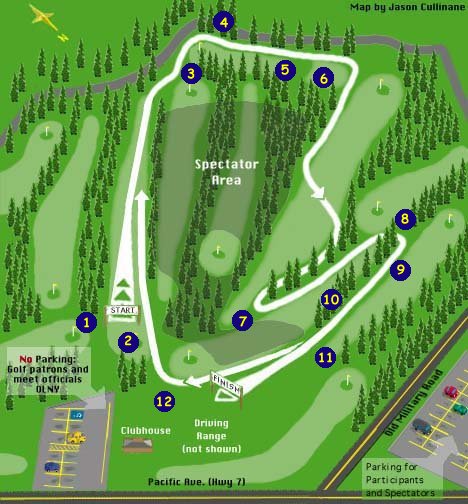
Click on any of the numbered dots on the map to see a photo of the course at that location.
If you have problems hit refresh button on your browser and wait until all pictures are downloaded
before pressing any numbered dots.
Thanks to Erik Palmer of Trackwire for scanning these pictures in.
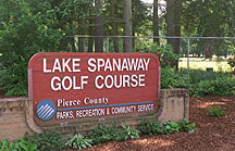 Entrance to Lake Spanaway Golf Course. |
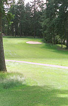
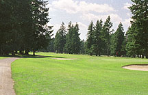 View of starting fairway from clubhouse parking lot. Starting line is located just beyound the green. |
|
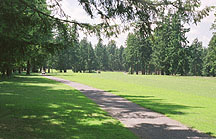
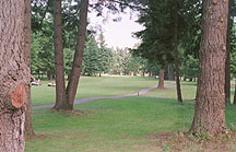
1 Runner's view of start from left side of starting line.
Runners have approximately 425m of open space before course veers to right at end of this fairway.
To Map |
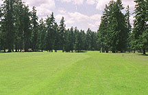
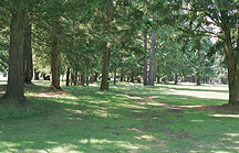
| 2 Runner's view of start from right side of starting line.
Runners have approximately 425m of open space before course veers to right at end
of this fairway. After runners complete the first 2000m loop, they will
run along the right side of this fairway on each loop.
To Map |
|
|
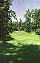
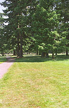
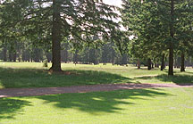
3 Side view of first turn. Runners exit the starting fairway on the
left side of the photo and climb along the incline from the left to right
side of the picture.
To Map |
| 4 Runner's view of the main incline on the course.
The photographer is standing about 600m into the loop. The course drops from this point
(running path is along left side of fairway), then rises to the highest point on the course.
The top of the rise is approximately 800m into the course. The incline rises approximately
30 feet in 90 meters.
To Map |
|
|
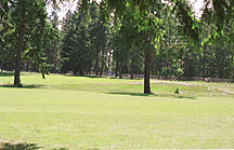
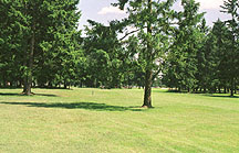
5 Backwards looking view from top of highest point on course.
Runners come around behind green and run down and up the right side of the fairway.
To Map |
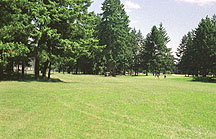
| 6 Runner's view from top of highest point on course.
Runners drop onto this fairway, then veer left at small post and cut across fairway near
the golf carts, then proceed down the left side of the fairway. The golf carts are parked
near the 1000m mark.
To Map |
|
|
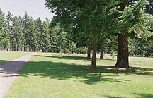
7 Runner's view after runners have made hard left turn coming off
fairway visible in the previous photo. Runners proceed up old cart path barely visible in center of photo.
The photographer is standing approximately 1200m into the course.
To Map |
| 8 Runner's view as course turns back towards the finish line.
The course cuts between the two big trees just to the right of the cart path.
Runners are about 450m from the finish at this point.
To Map |
|
|
9 Runner's view as course proceeds towards finish line.
Course passes just to the left of the two trees and starts to gradually curve to the
right after the trees. Runners are about 375m from finish at this point.
To Map |
| 10 Runner's view of course as it continues towards the finish.
Runners are currently about 250m from the finish. The finish area is visible on
the left center of the photo.
To Map |
|
|
11 Runner's view of the finish from 150m out.
The finish is located just to the left of the golf cart visible in the center of the photo.
The course passes to the right of the golf cart between the golf cart and the green and
curves right immediately behind the green to complete the loop.
To Map |
| 12 Runner's view of course as it proceeds back towards the start
fairway. Photographer is standing behind the green visible in 16a. The start line is
located on left side of photo at the small evergreen right behind the big tree visible
in left center of photo.
To Map |
|
| View of Lake Spanaway Golf Course Club House from the entrance. | 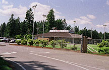 |
| Other Links | Sponsors |
|

|